
 >
>
 >
>


Time management is very much important in IIT JAM. The eduncle test series for IIT JAM Mathematical Statistics helped me a lot in this portion. I am very thankful to the test series I bought from eduncle.
Nilanjan Bhowmick AIR 3, CSIR NET (Earth Science)


- IIT JAM
- Geology (GG)
Explain dtm and dem .how these are used in civil engineering problem?
2 Answer(s)
Answer Now
- 1 Likes
- 2 Comments
- 0 Shares
-
![comment-profile-img]() >
>
-
![comment-profile-img]() >
>
Sajan sarthak
![best-answer]()
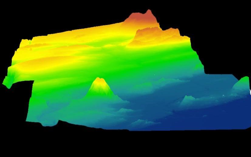
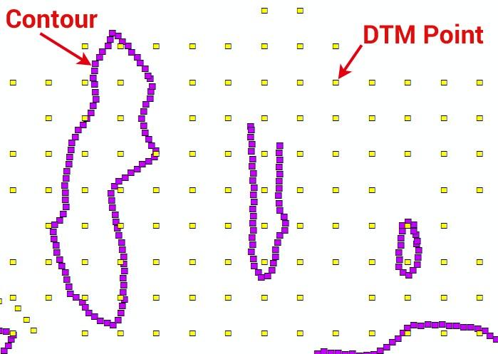
DEM A digital elevation model is a bare-earth raster grid referenced to a vertical datum. When you filter out non-ground points such as bridges and roads, you get a smooth digital elevation model. The built (power lines, buildings and towers) and natural (trees and other types of vegetation) aren’t included in a DEM. DTM DTMs are typically created through stereo photogrammetry like in the example above. For example, contour lines are in purple. The DTM points are regularly-spaced and characterize the shape of the bare-earth terrain. first figure is DEM &2ND IS DTM
![cropped1290655570202947089.jpg]()
![cropped2212264668938122909.jpg]()
Do You Want Better RANK in Your Exam?
Start Your Preparations with Eduncle’s FREE Study Material
- Updated Syllabus, Paper Pattern & Full Exam Details
- Sample Theory of Most Important Topic
- Model Test Paper with Detailed Solutions
- Last 5 Years Question Papers & Answers
Sign Up to Download FREE Study Material Worth Rs. 500/-


Rahul kumar![best-answer]()
Digital Terrain Model (DTM) is a part of DEM (Digital Elevation Model) in which terrains have been further enhanced with various parameters. DEM is generated from from variably spaced Lidar groud points and they can also be created using raster grids. Application in civil engineering: DEMs are very important sources of spatial information. Surface topography is the main factor in estimating catchment areas and surface water runoff. Nowadays DEM is used extensively for watershed modelling and monitoring. DEMs also play an important role in assessment of risks associated with natural hazards.