
 >
>
 >
>

Time management is very much important in IIT JAM. The eduncle test series for IIT JAM Mathematical Statistics helped me a lot in this portion. I am very thankful to the test series I bought from eduncle.
Nilanjan Bhowmick AIR 3, CSIR NET (Earth Science)


- IIT JAM
- Geology (GG)
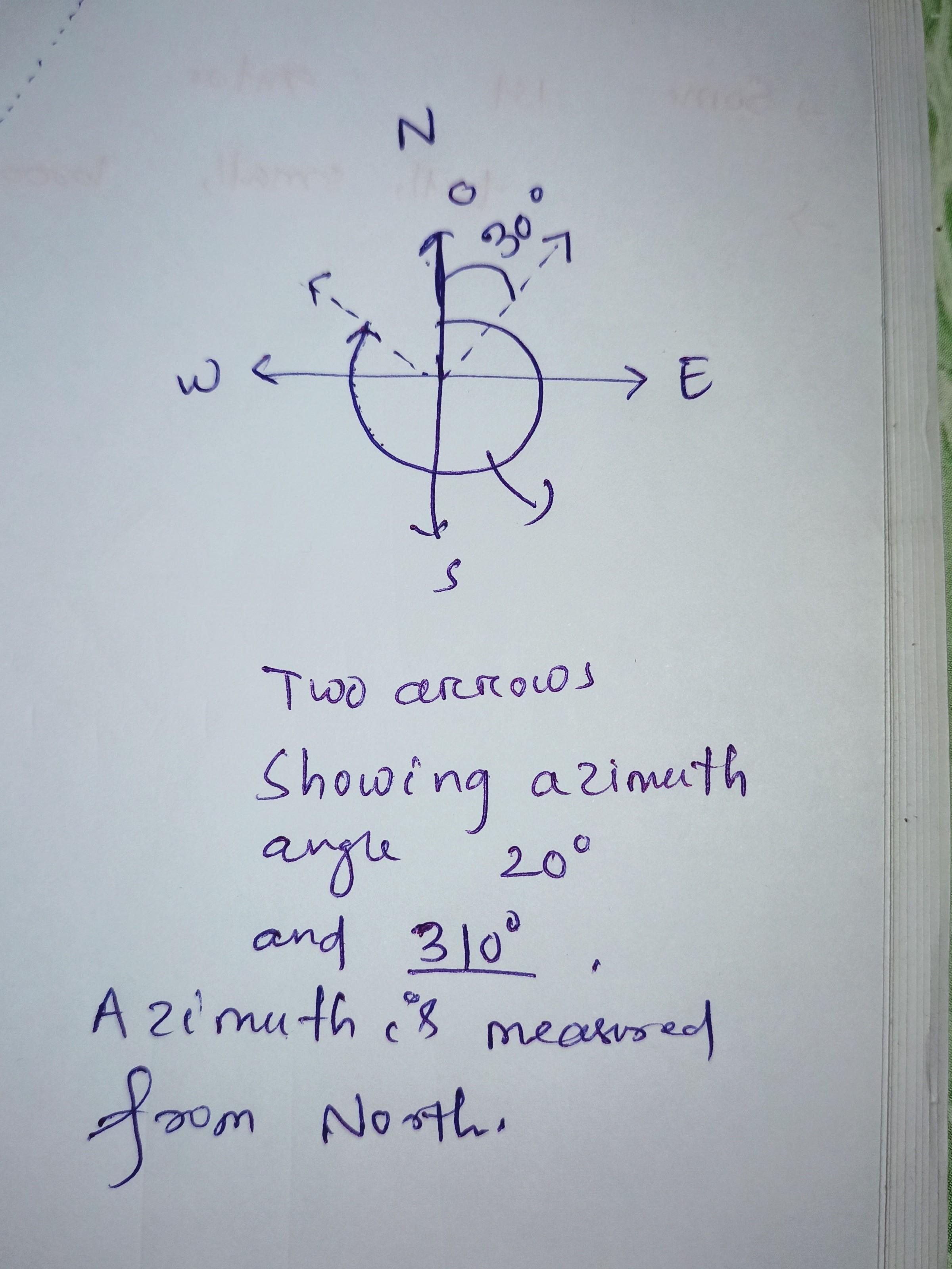
Plz sir explain this figure?
1 Answer(s)
Answer Now
- 1 Likes
- 2 Comments
- 0 Shares
-
![comment-profile-img]() >
>
-
![comment-profile-img]() >
>
Sajan sarthak Best Answer
This is a figure in which the flow direction is shown that is from high water head to low water head. and the arrows inside the angle from North (that is azimuth angle)
![cropped4155636654486909564.jpg]()
Do You Want Better RANK in Your Exam?
Start Your Preparations with Eduncle’s FREE Study Material
- Updated Syllabus, Paper Pattern & Full Exam Details
- Sample Theory of Most Important Topic
- Model Test Paper with Detailed Solutions
- Last 5 Years Question Papers & Answers
Sign Up to Download FREE Study Material Worth Rs. 500/-


Rahul kumar
The given figure is indicating the local water flow direction in a watershed. The bold solid line is indicating the drainage network (distributory channels). Small arrow with numbers (azimuths) are indicating local flow direction. The azimuth (for example, azimuth value of 135 indicates SE direction; 45 indicates NE direction; 315 indicates NW direction and so on) are scattered throughout the watershed area and can be used to determine the hydrological functions. Let me know if you have any further queries.